Ragonvalia, Norte de Santander, Colombia
Suggest Place to Visit
1162
Track to location with GPS |
 |
Around 1860, as a result of the civil war, some residents of Chinácota and El Chopo (today Pamplonita) emigrated to the banks of the Táchira River, crossing the mountain range. Thus, they established the first camps in the valley comprised by the Paso Antiguo and La Hormadera streams. In the historical archives, Miguel Contreras is one of the first to obtain property titles for these lands. This is how Juan Tarazona and Rafael Quintero also appear. The latter is regarded as the one who first drew the population.
By means of the decree issued by the president of the sovereign State of Santander, Solón Wilchees, on September 27, 1881, the Planadas district was created. On September 3, 1887, the Governor of the Santander department, General Alejandro Peña Solano, ´´ erected in the municipal district the Caseríos Planadas, Mundo Nuevo and ´´La Honda´´ that formerly belonged to Chinácota, by the limits indicated in corregimiento of that name. It will be the head of this new municipality of the La Planadas farmhouse; and its territory is assigned to the judicial circuit of the Chinácota notary's office ”.
In 1892, through the ordinance, the Santander Assembly replaced the name Planadas with Concordia, a sweet synonym of peace and unity, values that were deeply rooted in the spirit and conduct of the first settlers.
In 1930 on April 14, the Assembly of Norte de Santander, by means of ordinance 28 in its article 10, orders; ´´ Since the sanction of this Ordinance, the Concordia municipality will be called ´´ Ragonvalia´´ in honor of the great Patricio Ramón González Valencia´´.
Full Name: Ragonvalia
Foundation: 1860
Founder: Miguel Contreras.
Population: DANE 2005 Census: 6,800 inhabitants
Altitude: 1,550 meters above sea level.
Extension: 102 Km2
Climate: Average 20º C.
Distance to Cúcuta: 70 Km.
Geographic coordinates: Longitude west of Greenwich 72º 29´, North latitude 7º 35´
Limits: North: Los patios and Villa del Rosario,
South: Herrán,
East: Republic of Venezuela,
West: Chinácota.
Administrative Division: Composed of the municipal seat and 14 sidewalks.
Rivers: The following streams: El Indio, Margarijá, La Honda, Agua blanca, La Pegadera, La Samagala, La Carolina, Agua Negra, Penjuil.
Region: South East
Economy:
Agricultural production: coffee, arracacha, sugar cane, morón, tree tomato and fruits.
Livestock production such as cattle, pigs and poultry.
Holidays:
January 1 to 16: Santo Niño de Atocha, Patron
September 30: Anniversary of the Foundation
Easter
Christmas bonus
Tourist sites:
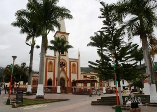
Parish church
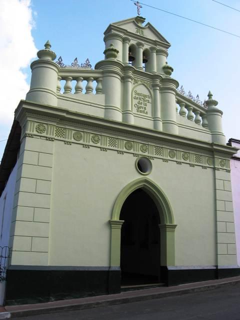
Sanctuary of the Holy Child of Atocha
Simón Bolívar Main Park
Monument to the Holy Cross, on the road to the Oasis
Alliance International Bridge
Comments
We don´t have yet any comments about:
City Ragonvalia
City Ragonvalia
Be the first to leave a comment as it is very important to inform other people
Outros locais a visitar
Within a radius of 20 km from:City Ragonvalia
Herran |
| 7,8 Km |
 |
São João Batista da Chinacota |
| 14,4 Km |
 |
Cidade Pamplonita |
| 14,7 Km |
 |
Bochalema |
| 19,4 Km |
 |
Hotel reservation near City Ragonvalia within a radius of 20 km
No results
Why to book with CLUBE TRAVEL
The best prices
Our partnerships with the world´s largest operators offer research on the best market prices.
More options
At Rotas Turisticos you can book the hotel, buy the air ticket, book the transfer from the airport to the hotel and vice versa, book the local excursions, rent the car, take travel insurance and consult the places to visit and where to go.
Holiday Tips & Destinations
Hundreds of holiday destinations with all the options that allow you to easily choose the destination that best suits your dream vacation.
CLUBE TRAVEL
Links


